Geography in Kenya
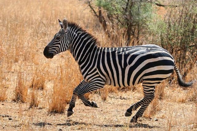
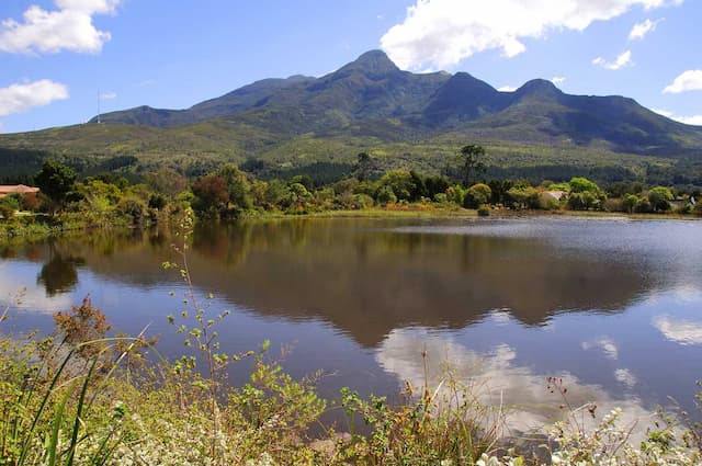
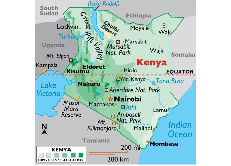
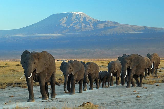
The topography of Kenya is various. The nation has a coastline on the Indian Ocean, which contains bogs of East African mangroves, coconut palm trees and a few patches of tropical rainforest. Kenya's inland comprises of expansive fields and numerous slopes. Focal and Western districts are portrayed by the Great Rift Valley home to two of Africa's most noteworthy mountains, Mount Kenya and Mount Elgon. Kakamega Forest, arranged in Western Kenya is relic of an East African rainforest. A lot bigger is Mau Forest, the biggest indigenous montane backwoods in East Africa.
The nation involves a region of 580,367 square kilometers, 49th on the planet, somewhat more than double the span of Nevada. All out land zone: 569,140 square kilometers. All out water zone: 11,227 square kilometers. The Kenyan Highlands include a standout amongst the best horticultural generation locales in Africa; ice sheets are found on Mt Kenya; novel physiography bolsters copious and fluctuated natural life of logical and monetary esteem.
Top tour packages
Kenya Migration Special
Nairobi (1N) Masai Mara (2N), +1 more
Flight Not Included
₹1,48,150
per person
- Valid upto 17 Sep 2026
Kenyan Delight
Nairobi (1N) Masai Mara (2N), +1 more
Flight Not Included
₹1,61,490
per person
- Valid upto 30 Dec 2026
Highlights Of Kenya With Aberdare
Nairobi (1N) Aberdare National Park (1N), +2 more
Flight Not Included
₹1,86,390
per person
- Valid upto 30 Dec 2026
Kenya Migration Special With Amboseli
Nairobi (1N) Masai Mara (2N), +2 more
Flight Not Included
₹2,13,430
per person
- Valid upto 17 Sep 2026
Highlights Of Kenya With Samburu
Nairobi (1N) Aberdare National Park (1N), +3 more
Flight Not Included
₹2,31,120
per person
- Valid upto 30 Dec 2026
Highlights Of Kenya With Mombasa Private Tour
Nairobi (1N) Aberdare National Park (1N), +3 more
Flight Not Included
₹2,35,000
per person
- Valid upto 30 Dec 2026
Highlight Of Kenya With Amboseli
Nairobi (1N) Amboseli National Park (2N), +2 more
Flight Not Included
₹2,50,000
per person
- Valid upto 30 Dec 2026
Enchanting South Africa With Kenya – Private Tour
Nairobi (1N) Masai Mara (2N), +5 more
Flight Not Included
₹3,32,320
per person
- Valid upto 31 Oct 2026
Enchanting South Africa With Kenya & Victoria Falls– Private Tour
Nairobi (1N) Masai Mara (2N), +6 more
Flight Not Included
₹3,92,600
per person
- Valid upto 31 Oct 2026
Highlights Of Kenya & Tanzania
Nairobi (1N) Naivasha (1N), +5 more
Flight Not Included
₹3,99,080
per person
- Valid upto 30 Dec 2026
Kenya With Tanzania Migration Special
Nairobi (1N) Masai Mara (2N), +5 more
Flight Not Included
₹4,25,470
per person
- Valid upto 17 Sep 2026
Highlight Of Kenya & Tanzania With Zanzibar
Nairobi (1N) Naivasha (1N), +6 more
Flight Not Included
₹4,81,580
per person
- Valid upto 31 Dec 2026
African Jambo
Johannesburg (1N) Sun City (2N), +5 more
Main + Internal Flight Included
₹4,84,600
per person
- May
Happy Travellers
A Special First International Trip for My Parents
Ms. Kavita Jain
 Dec
DecA Wonderful and Memorable Tour Experience
Mr. Vimal Virani
 Dec
DecA Wonderful Diwali Family Vacation with Flamingo
Mr. Kirit S. Patel
 Oct
OctA Magical Cherry Blossom Experience in Japan
Mr. Mayank Jarivala
 Nov
NovWonderful Japan Tour Experience
Mr. Nita Patel
 Dec
DecNot Just a Tour, But a Beautiful Family Experience
Mr. Sanjiv & Ms. Dipika
 Nov
NovA Remarkable Japan Tour Filled with Care, Knowledge and Excellence
Mr. Ambrish & Ms. Rupa Shah
 Oct
OctThank You Flamingo for an Amazing Japan Journey
Mr. Bhavin Patel & Ms. Vaishali Patel
 May
MayMemorable Japan Tour with Exceptional Tour Management
Ms. Surbhi Udeshi
 Mar
MarA Great Success Thanks to Your Dedicated Efforts
Mr. Yogesh kanthawala & Ms. Sonal Kanthawala
 Feb
FebTrending travel articles

Affordable Bali Trip Under ₹30000 – Flamingo Transworld Budget Itinerary for First-Time Travelers
Summary: Looking for a budget-friendly Bali trip in 2026? This blog shows how you can enjoy a relaxing 5-day Bali Trip under ?30000/- by choosing smart stays, simple food and the right places. Perfect for first-time Indian travellers looking for a budget-friendly Bali holiday. We all have seen tons of pics of temples, Bali Swing, […]

Japan Tour Packages from India Under ₹3 Lakh – Explore Japan on a Budget
Summary: Your dream of exploring Japan is possible, even with a strict budget! This blog shares how Japan tour packages from India under ?3 lakh are possible. It covers real costs, budget tips, the best time to visit, and much more. It helps you understand how to save money and still enjoy a great Japan […]

Singapore Tour Packages from India Under ₹1 Lakh – Budget-Friendly Trips 2025-26
Summary: A trip to Singapore can fit your budget with the right plan. This blog explains how Singapore tour packages from India under ?1 lakh work, what costs to expect, and how to save money. It helps you understand the best places to visit in Singapore in 2026 so you can enjoy this island country […]

Top Indian Restaurants in Hanoi to Try in 2026!
Summary: Indian restaurants in Hanoi are more than just places to eat. They serve Indian food with a Vietnamese welcome. Whether you are a vegetarian, prefer halal food, or just miss home-style dal, these restaurants have it all. Every meal is served with care and a friendly smile, making you feel right at home in […]

Macau – A city that refuses to sleep , and wont let you either !
Summary: Macau Travel – Macau is a city that never slows down—filled with luxury hotels, thrilling attractions, endless nightlife, and unforgettable energy. From staying at The Venetian to breathtaking Macau Tower views and vibrant casinos, Muskan Golecha’s experience captures the true spirit of a city that you don’t just visit, you live! Macau is one […]

10 Days Itinerary for Switzerland – Perfect Trip Plan for First-Time Visitors!
Summary: If you want a calm, scenic, and well-paced trip, this 10 days itinerary for Switzerland is made for you. It suits families, honeymooners, seniors, and solo travellers. This plan combines top attractions with relaxed, easy travel days. It also keeps Indian comfort in mind. Read on to get the full day-by-day plan, smart tips, […]

Switzerland in Winter 2026: A Fairytale Experience of Snow, Alps & Christmas Markets!
Summary: Switzerland in winter 2026 is pure magic, snow-dusted Alps, glittering Christmas markets, and cozy wooden chalets bring fairytales to life. Whether you are sipping hot chocolate by the beautiful Swiss lakes or exploring the festive streets of cities, it feels like a movie. Perfect for Indian travellers, families, and honeymooners. This blog helps you […]

Christmas in Dubai 2025: Lights, Luxury & Festive Shopping!
Summary: Experience the magic of Christmas in Dubai 2025, where the city sparkles with lights, music, and festive cheer. From grand events to lively markets and fireworks, every corner feels joyful. Enjoy delicious food, family fun, and exciting shopping deals during the Dubai festive season. Plan your trip easily with Dubai Tour Packages and make […]

Bhutan In December 2025- Weather, Insider Tips, Best Time to Visit, and Things to Do!
Summary: Experience the magic of a trip to Bhutan in December 2025, with clear skies, vibrant festivals, fewer crowds, and stunning mountain views. This blog guides you through weather updates, travel tips, places to visit, and must-try experiences for your perfect Bhutan holiday. Plan your relaxing, crowd-free visit to Bhutan and experience the authentic charm […]

How to Plan A Budget Trip To Vietnam Under ₹60,000!
Summary: Trip To Vietnam Under ?60000 – Dreaming of travelling to Vietnam without stretching your wallet? This blog shares how to plan your trip to Vietnam under ?60,000. It shares everything, including flights, hotels, meals, and activities. Discover must-visit cities, real cost breakdown, and much more to make your Vietnam tour package memorable yet budget-friendly. […]


.jpg&w=640&q=75)



.jpg&w=640&q=75)


