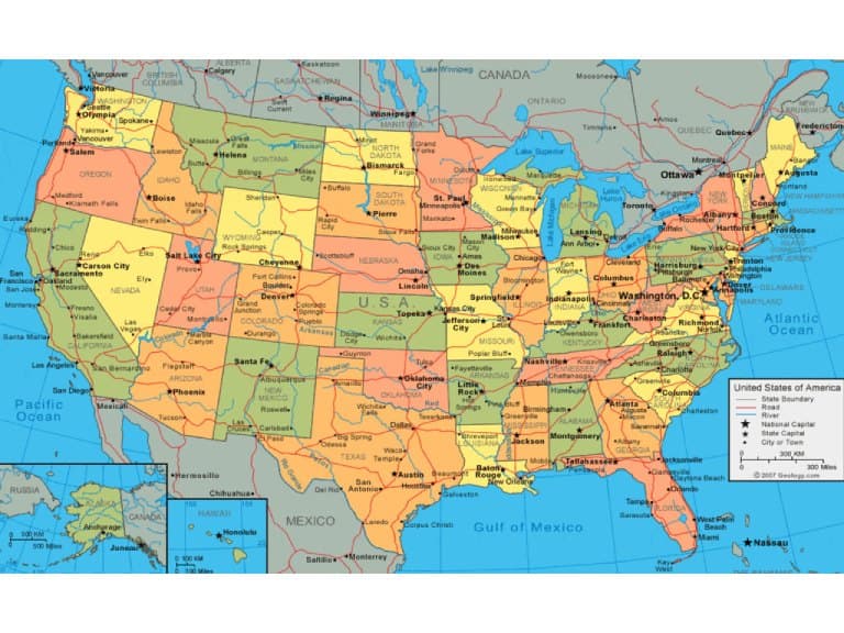
Geography in United States of America
Top Tour Packages

American Explorer East
New York City (2N), Washington (1N), Niagara Falls USA (2N)
Flight Not Included
₹2,11,540
per person- Aug
- Nov
- Oct
- Sep

American Explorer West
Las Vegas (3N), Los Angeles (2N), San Francisco (2N)
Flight Not Included
₹2,25,970
per person- Aug
- Nov
- Oct
- Sep

American Escape West
San Francisco (2N), Los Angeles (2N), Las Vegas (3N)
Flight Not Included
₹2,25,970
per person- Aug

American Western Wonders With Mexico Cruise
San Francisco (3N), Las Vegas (3N), Los Angeles (2N), Cruise (3N)
Internal Flight Included
₹3,79,810
per person- Dec
- Jan

American Escape
San Francisco (2N), Los Angeles (2N), Las Vegas (3N), Niagara Falls USA (2N), Washington (1N), New Jersey (2N)
Internal Flight Included
₹3,99,040
per person- Aug

American Explorer
New York City (2N), Washington (1N), Niagara Falls USA (2N), Las Vegas (3N), Los Angeles (2N), San Francisco (2N)
Internal Flight Included
₹4,27,890
per person- Aug
- Nov
- Oct
- Sep

American Experience East & West
New York City (2N), Washington (1N), Niagara Falls USA (2N), Las Vegas (3N), Los Angeles (2N), San Francisco (2N)
Internal Flight Included
₹4,47,120
per person- Aug
American Dreams Orlando & East
Orlando (4N), Cruise (3N), Niagara Falls USA (2N), Washington (1N), New Jersey (1N), New York City (2N)
Internal Flight Included
₹5,38,470
per person- Aug

American Experience
New York City (2N), Washington (1N), Niagara Falls USA (2N), Las Vegas (3N), Los Angeles (2N), San Francisco (2N), Orlando (3N)
Internal Flight Included
₹5,57,700
per person- Aug
- Nov

California Route 66
Santa Monica (1N), Pasadena (1N), San Bernardino (1N), Barstow (1N), Needles (1N)
Flight Not Included
₹1,10,580
per person- Valid upto 31 Mar 2027

Amazing Alaska
Anchorage (2N), Seward (2N), Talkeetna (1N), Denali (2N), Fairbanks (2N)
Flight Not Included
₹5,62,500
per person- Valid upto 31 Mar 2027
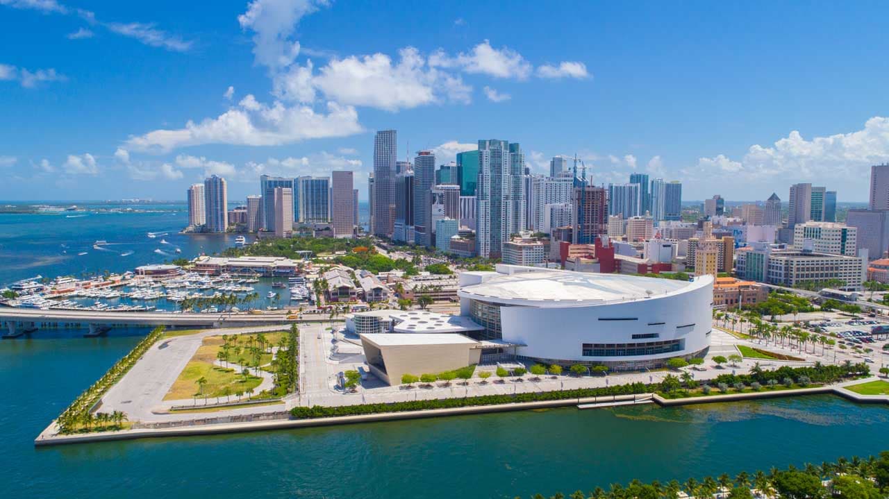
Family Fun Florida - SIC
Orlando (4N), Miami (2N)
Flight Not Included
₹1,00,870
per person- Valid upto 31 Mar 2027

USA West Coast With Monterey - SIC
San Francisco (2N), Monterey (1N), Los Angeles (3N), Las Vegas (3N)
Flight Not Included
₹1,11,830
per person- Valid upto 31 Mar 2027

Kids Special Florida - SIC Tour
Orlando (5N), Miami (2N)
Flight Not Included
₹1,28,560
per person- Valid upto 31 Mar 2027


Elegant East with Boston - SIC Tour
New York City (2N), Washington (2N), Niagara Falls USA (2N), Boston (2N)
Flight Not Included
₹1,77,220
per person- Valid upto 31 Mar 2027

Los Angeles & Surround
Los Angeles (4N), Los Angeles (3N)
Flight Not Included
₹1,47,700
per person- Valid upto 31 Mar 2027


Elegant East - SIC Tour
New York City (2N), Niagara Falls USA (2N), Washington (2N)
Flight Not Included
₹1,73,370
per person- Valid upto 31 Mar 2027
USA West Coast - SIC
San Francisco (3N), Las Vegas (3N), Los Angeles (3N)
Flight Not Included
₹1,80,770
per person- Valid upto 31 Mar 2027
East With Philadelphia
New York City (2N), Philadelphia (3N), Washington (2N), Niagara Falls USA (2N)
Flight Not Included
₹2,01,930
per person- Valid upto 31 Mar 2027

Aloha Hawaii - SIC Tour
Honolulu (4N), Kauai (2N), Maui Island (3N), KailuaKona (2N)
Flight Not Included
₹3,61,830
per person- Valid upto 31 Mar 2027

San Francisco & Surroundings
San Francisco (7N)
Flight Not Included
₹2,07,790
per person- Valid upto 31 Mar 2027

Outstanding Utah
St George (3N), Salt Lake City (2N)
Flight Not Included
₹1,73,080
per person- Valid upto 31 Mar 2027

Musical South - Self Drive
Dallas (2N), Houston (2N), New Orleans (2N), Indianola (1N), Birmingham (2N)
Flight Not Included
₹1,07,500
per person- Valid upto 31 Mar 2027

South USA - Self Drive
Orlando (4N), Savannah (2N), Atlanta (2N)
Flight Not Included
₹2,07,410
per person- Valid upto 31 Mar 2027

Pacific Coastal Beauty Self Drive
Las Vegas (3N), Los Angeles (3N), Cambria (1N), Monterey (1N), San Francisco (3N)
Flight Not Included
₹2,47,500
per person- Valid upto 31 Mar 2027

Virginia And Philadelphia - Self Drive
Virginia Beach (2N), Norfolk (1N), Charlottesville (1N), Staunton (1N), Washington (2N), Philadelphia (3N), Philadelphia (2N)
Flight Not Included
₹2,64,430
per person- Valid upto 31 Mar 2027

USA West Coast With Mammoth Lakes
Los Angeles (2N), Palm Springs (1N), Las Vegas (2N), Mammoth Lakes (2N), South Lake Tahoe (2N), San Francisco (2N)
Flight Not Included
₹2,93,750
per person- Valid upto 31 Mar 2027
Experience Utah
St George (1N), Springdale (1N), Bryce Canyon (1N), Torrey (1N), Bluff (1N), Moab (2N), Salt Lake City (2N)
Flight Not Included
₹3,71,640
per person- Valid upto 31 Mar 2027

Happy Travellers
Memorable Spain And Portugal Journey with Flamingo
MS.Shilpa Parikh

Amazing USA West Coast Journey with Flamingo
MR.Atul Patt

Memorable Dubai Tour Experience
MR.Nitin Jariwala
Our Dubai tour was truly memorable. The hotel was good & the food was also good. Our Tour Manager Akbar Bhai had a very friendly and approachable nature. He provided quick responses to all queries. He offered excellent guidance for our visits, giving instructions repeatedly and on time to everyone. He also gave helpful guidance for shopping and purchases.

Memorable Spain And Portugal Tour with Flamingo Travels
MR. Bharat Patel

Great And Wonderful Vacation with Flamingo Travels
MR .Govind Patel

Memorable Spain And Portugal Vacation with Flamingo
MR. Jagdish Patel

Wonderful Spain And Portugal Trip with Perfect Planning And Execution
MR. Kaushik Patel

Incredible Spain And Portugal Journey with Wonderful Memories
MR. Virendra Patel

Amazing Spain And Portugal Tour Experience with Flamingo Travels
MR. Pankaj Patel

Knowledgeable Caring Tour Manager With Flamingo Travels
MR. Rohit Patel

Trending travel articles

Summary: Looking for a budget-friendly Bali trip in 2026? This blog shows how you can enjoy a relaxing 5-day Bali Trip under ?30000/- by choosing smart stays, simple food and the right places. Perfect for first-time Indian travellers looking for a budget-friendly Bali holiday. We all have seen tons of pics of temples, Bali Swing, […]

Summary: Your dream of exploring Japan is possible, even with a strict budget! This blog shares how Japan tour packages from India under ?3 lakh are possible. It covers real costs, budget tips, the best time to visit, and much more. It helps you understand how to save money and still enjoy a great Japan […]

Summary: A trip to Singapore can fit your budget with the right plan. This blog explains how Singapore tour packages from India under ?1 lakh work, what costs to expect, and how to save money. It helps you understand the best places to visit in Singapore in 2026 so you can enjoy this island country […]

Summary: Indian restaurants in Hanoi are more than just places to eat. They serve Indian food with a Vietnamese welcome. Whether you are a vegetarian, prefer halal food, or just miss home-style dal, these restaurants have it all. Every meal is served with care and a friendly smile, making you feel right at home in […]

Summary: Macau Travel – Macau is a city that never slows down—filled with luxury hotels, thrilling attractions, endless nightlife, and unforgettable energy. From staying at The Venetian to breathtaking Macau Tower views and vibrant casinos, Muskan Golecha’s experience captures the true spirit of a city that you don’t just visit, you live! Macau is one […]

Summary: If you want a calm, scenic, and well-paced trip, this 10 days itinerary for Switzerland is made for you. It suits families, honeymooners, seniors, and solo travellers. This plan combines top attractions with relaxed, easy travel days. It also keeps Indian comfort in mind. Read on to get the full day-by-day plan, smart tips, […]

Summary: Switzerland in winter 2026 is pure magic, snow-dusted Alps, glittering Christmas markets, and cozy wooden chalets bring fairytales to life. Whether you are sipping hot chocolate by the beautiful Swiss lakes or exploring the festive streets of cities, it feels like a movie. Perfect for Indian travellers, families, and honeymooners. This blog helps you […]

Summary: Experience the magic of Christmas in Dubai 2025, where the city sparkles with lights, music, and festive cheer. From grand events to lively markets and fireworks, every corner feels joyful. Enjoy delicious food, family fun, and exciting shopping deals during the Dubai festive season. Plan your trip easily with Dubai Tour Packages and make […]

Summary: Experience the magic of a trip to Bhutan in December 2025, with clear skies, vibrant festivals, fewer crowds, and stunning mountain views. This blog guides you through weather updates, travel tips, places to visit, and must-try experiences for your perfect Bhutan holiday. Plan your relaxing, crowd-free visit to Bhutan and experience the authentic charm […]

Summary: Trip To Vietnam Under ?60000 – Dreaming of travelling to Vietnam without stretching your wallet? This blog shares how to plan your trip to Vietnam under ?60,000. It shares everything, including flights, hotels, meals, and activities. Discover must-visit cities, real cost breakdown, and much more to make your Vietnam tour package memorable yet budget-friendly. […]